About
PC2Products (Point Cloud to Products) is the BERA Tools category for turning LiDAR point clouds
(.las / .laz) into raster products such as a DTM, DSM, CHM and hummock/hollow
maps. It also includes tools for checking the input data, classifying ground points, mapping surface
water and depth to water, and comparing seismic lines with the surrounding peatland.
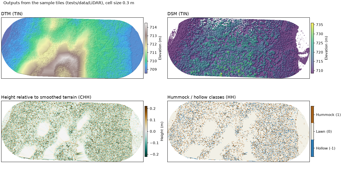
Rasters produced from the sample tiles in tests/data/LiDAR/ (ground-classified with CSF first, cell
size 0.3 m). Top: DTM and DSM, both built with TIN. Bottom: the hummock/hollow tool's two outputs,
using Smooth_by = median, Min_ws = 3 and lawn_range = 0.1.
Each tool is a thin Python wrapper in beratools/tools/. It validates the inputs and then calls an
R function in r_scripts_collection.r through rpy2. The R functions use
lidR to do the processing. The tools appear under the
PC2Products category in the BERA Tools GUI, and as subcommands of the bt command.
- Overview: the tools at a glance
- User Guide: typical workflow and how to run the tools
- Technical Guide: how the tools run and how R is located
Credit
PC2Products is part of BERA Tools, from the Boreal Ecosystem Recovery and Assessment (BERA) Project, and is developed by the Applied Geospatial Research Group.
Reference
Surface Water Mapping, Depth-to-Water from Surface Water and Seismic Line Disturbance Analysis follow Chan, Dabros & McDermid (2026), Microtopographic and Hydrological Response to Repeated Seismic Line Disturbance in a Boreal Fen of Northern Alberta, Canada, Forests 17, 489.